BASF Offers Farmers Cloud-Free Biomass Images

Farmers gain daily access to biomass images derived from satellites.
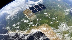
BASF Digital Farming GmbH, in collaboration with VanderSat, says it will be the first company globally to offer the agricultural industry access to scalable, daily biomass images derived from satellites and unimpeded by cloud cover. The two companies have signed a commercial agreement, which will integrate VanderSat’s fully operational Cloud-free Biomass product with BASF Digital Farming’s xarvio Field Manager offering. The technology is expected to be available in North America by the end of March 2021.
Using the technology via xarvio Field Manager, farmers will get daily access to high quality, consistent, cloud-free biomass images. Faster access to biomass images enables consistent monitoring of crop growth and leads to enhanced agronomic decisions. This optimizes crop production, saves time and money and supports on-farm sustainability efforts through enhanced application efficiency of crop inputs, according to BASF.
Cloud-free Biomass is the result of close collaboration and testing by xarvio and VanderSat teams across the last two years. The new product was successfully tested in Germany, Ukraine, United Kingdom, Canada and Brazil, according to BASF. It has a high spatial resolution (10 meters x 10 meters) and provides a single, consistent metric of crop biomass. This allows farmers to compare the performance of several fields over a large area, or in different growing seasons.
Integrating three different satellite products together, Cloud-free Biomass uses VanderSat’s patented retrieval method for passive microwave technology along with active microwave from the European Space Agency’s (ESA) Sentinel-1 satellite, and optical images from its Sentinel-2 satellite. VanderSat then uses its expertise in remote sensing to interpret the output from these data sources to provide a reliable, daily measure of crop biomass.
In some parts of North America, biomass images are significantly obstructed by cloud cover. At times it can take more than two weeks to receive a “clean” biomass image, which by then is usually outdated because crop conditions have changed. Cloud-free Biomass images are available daily. Unlike Normalized Difference Vegetation Index (NDVI) biomass images from satellites, which are not available on cloudy days and only measure spectral greenness, Cloud-free Biomass also measures biophysical parameters and water content in vegetation to continually and accurately calculate all stages of crop growth during the entire growing season.
For more information, visit: www.xarvio.com